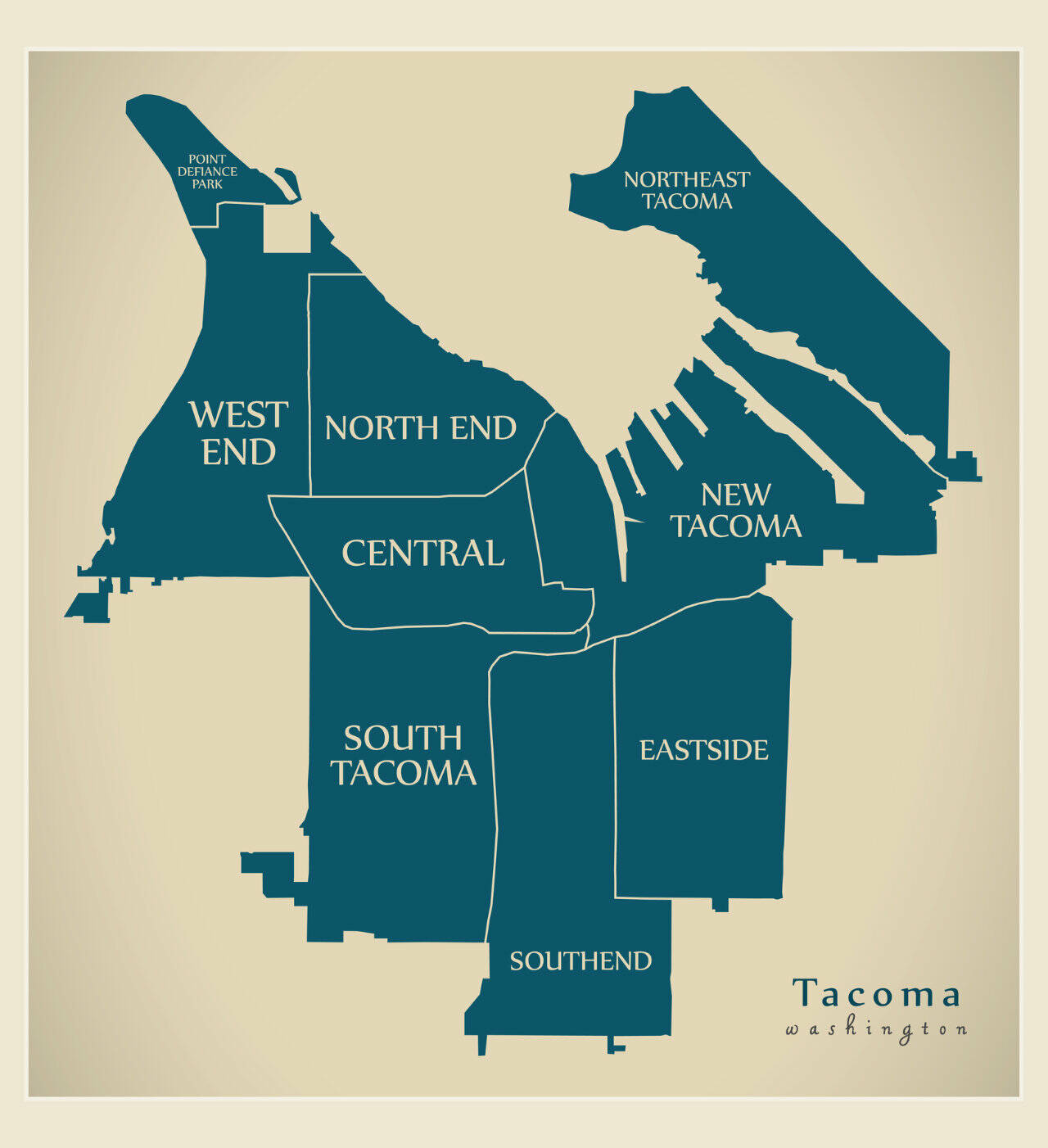
Most cities, or at least their official boundaries, have semi-regular shapes or what could be called their urban footprint. The most common shape is something approximating a circle or square.
You could picture most historic cities as a central core with avenues or streets radiating out.
Even Seattle (mostly thanks to its water-defined boundaries) is almost rectangular.
Cities, are, of course, not always in an infinite wide-open space. They may be as defined by their geography as they are by their histories. You can see an exploration of how our cities are defined by their shapes here.
Most of us recognize cities by their skylines. From posters to video backgrounds, skylines, from New York to Paris to Shanghai to many more are, in many cases, the most immediately unique recognizable feature of our major, or at least most well-known urban areas.
But when it comes to everyday living, working and commuting, any city’s footprint is far more important and defining than skylines.
How we get around – or even where we go within our own city – is all too often defined or restrained (usually without our noticing) by how “compact” and accessible our city is.
Most historic cities, from Europe to Asia and Africa, were, usually without putting it into policy or even conscious thought, designed (semi-accidently) around access.
Up until less than a century ago, access meant access by foot or small carts.
No one, from resident to urban planners, used the term “walkable” – but for any city was to grow and thrive, it had to be.
By the middle of the 20th Century, virtually every city was designed around automobiles – and the infrastructure, from parking lots to highways, that facilitate their (automobiles) access.
In other words, historic cities found themselves, again, semi-accidently, designed or framed around access.
But this time it was mechanical.
Skylines are attractive – but they are not where we live
As mentioned above, skylines are often our most vivid and most common first impression, but, as much as we (and most visitors) might be entranced by them, we don’t live and move and make our livings among them -but we do directly encounter our city’s footprint.
Partly because of our terrain, and because of our history, most cities in the Puget Sound area, if not the entire state, barely have a noticeable, definable skyline.
Tacoma and Everett, for example, largely due to their location, barely have skylines at all.
A city, to have a memorable skyline, needs to have a vantage point – a place from which we can take in the vista before us.
For many of us, the primary, and usually the first, view of any city is from our vehicle.
Seattle has multiple freeway-sourced vistas. Most of them are complimentary and show the city’s best sides – especially during sunsets or dramatic weather.
Other cities, from Tacoma to Olympia to Everett to Yakima, not so much.
It has been said that a house is “a machine for living in”.
A city, is, at its most basic, a vastly larger and more complicated “machine for living in”.
In short, a city should make “living in it” as practical and productive as possible.
And cities should be defined – at the ground level
One of the things that makes everything from zoning to speed limits so confusing is knowing exactly where we are at any given moment.
Our vehicles travel quickly and our urban boundaries are in many cases, not clearly defined.
I’ve often thought, for example, that cities should, at minimum, clearly mark their boundaries – perhaps with a painted or dotted line.
Certain laws, from the use of fireworks to building codes are dictated by city jurisdiction, but how do we keep track or even know which city’s jurisdiction we are currently bound by?
In most of the Puget Sound area, for example, city limits are not always clear or visible. Even some county boundaries (as in the Pierce County/King County boundary) are not clearly defined.
But besides being confusing, having indistinct boundaries can work to our advantage.
When I try to contact someone, I often get the message “I’m out of town”.
If one lives or works in Tacoma, for example, if you find yourself at Trader Joe’s or Whole Foods, you are technically in University Place. Or if you find yourself at the intersection of South 19th and Mildred, you find yourself at the nexus of Fircrest, University Place and Tacoma.
The same vague sense is true in many other corners or edges of Tacoma – and many other cities.


